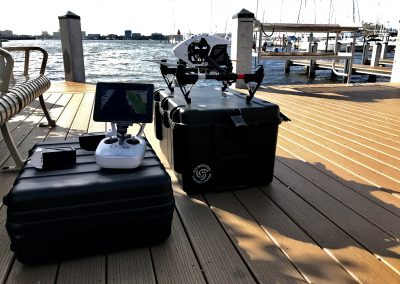
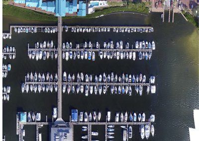
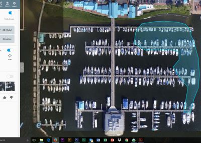
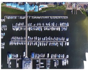
On Dec. 15th, 2017, Southern Manatee Fire Rescue District’s Special Operations team was requested to assist the North River Fire District with a leaking marine vessel in the 1000 block of Riverside Dr., Palmetto, Florida. SMFR units arrived on scene and consulted with the Incident Commander along with the U.S. Coast Guard and were immediately requested to assist with spill tracking. Using our aerial systems, we were able to visually monitor the spill and also create an orthorectified map map of the marina in real time. This map allowed us to see the size and scope of the area affected. (To the right of the Marina in the image below, you can see a light blue film in the water extending all the way to the shore.)
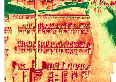
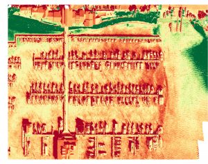
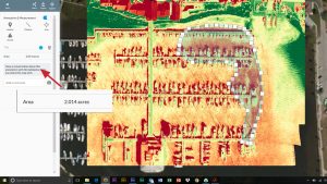
Using filters in the mapping software, we were able to show in great detail the area of the fuel spill. (The redish/orange area on the yellow water is showing the fuel)
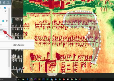
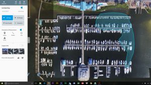
By selecting the boundaries of the fuel in the software, we were able to determine the area of the fuel spill. In this image you can see that there was 2.014 acres of the marina affected by the spill at the time the photos were taken.
Utilizing our drone to map the area and using software to convert the map into trackable data, we were able to show yet another valuable use for this tool. It was estimated the spill area was over 2 acres effected from 100 gallons of Red Diesel that was discharged from the vessel. While on scene, SMFR also accomplished air monitoring and was able to assist the clean-up contractor with forced ventilation allowing their crews to work safely within a confined space. To learn more about our UAS program, please contact Capt. Bloski at 941-725-0785 or mbloski@smfr.com.

